
Walk a Portage Street Record
A sound Portage street directory search moves from the physical address to records that identify the parcel, then to records that explain title and past use. The current owner may live elsewhere, and several people may share a home without appearing on the tax card. Treat every match as one piece of evidence.
- Enter the address in the Porter County XSoft search. Save the parcel number, situs address, owner, mailing address, legal description, and transfer tabs.
- Open the parcel map. Follow lot lines and road frontage, then note municipality, township, buildings, and nearby parcel numbers.
- Use the owner and legal description in Recorder Direct Search. Search a current owner as grantee and a prior owner as grantor.
- Ask Portage for permit or code files by exact address and date span. No public citywide permit index was verified.
- For an older household, test historic street labels in maps and directories, then confirm the name with census, obituary, or probate material.
This order prevents a tax mailing label from being mistaken for proof of occupancy. It also gives each later office a parcel number or legal description that is less fragile than street spelling.
Record the source date at each step. XSoft is a current assessment system, the deed index records transactions, and a printed directory describes only its publication year. If two names differ, do not choose one on instinct. Check whether the parcel transferred, whether the owner is a trust or estate, and whether the mailing address belongs to someone who lives elsewhere. For family-history work, a census or obituary may support an occupant while the deed supports the owner. Those are related facts, but they are not interchangeable.
Portage Street Directory Fields
XSoft is the strongest first stop for a current Portage address. Its main screen accepts owner name, property address, or parcel number. Advanced Search has no plain ZIP box, but it can narrow results by district, neighborhood, property class, sale data, building traits, and land size.
| Search control | Format | Street use |
|---|---|---|
| Property address | Street text | Finds the parcel tied to a situs address. |
| Parcel number | County identifier | Reopens one exact property despite address variants. |
| District Name | Dropdown | Separates city, township, and Westchester contexts. |
| Neighborhood | Searchable list | Finds subdivisions and portal spelling variants. |
| Sale Date and Price | Ranges | Narrows parcels by a known transfer period. |
| Year Built and Area | Ranges | Distinguishes similar properties. |
The Porter County Advanced Search shows those controls.
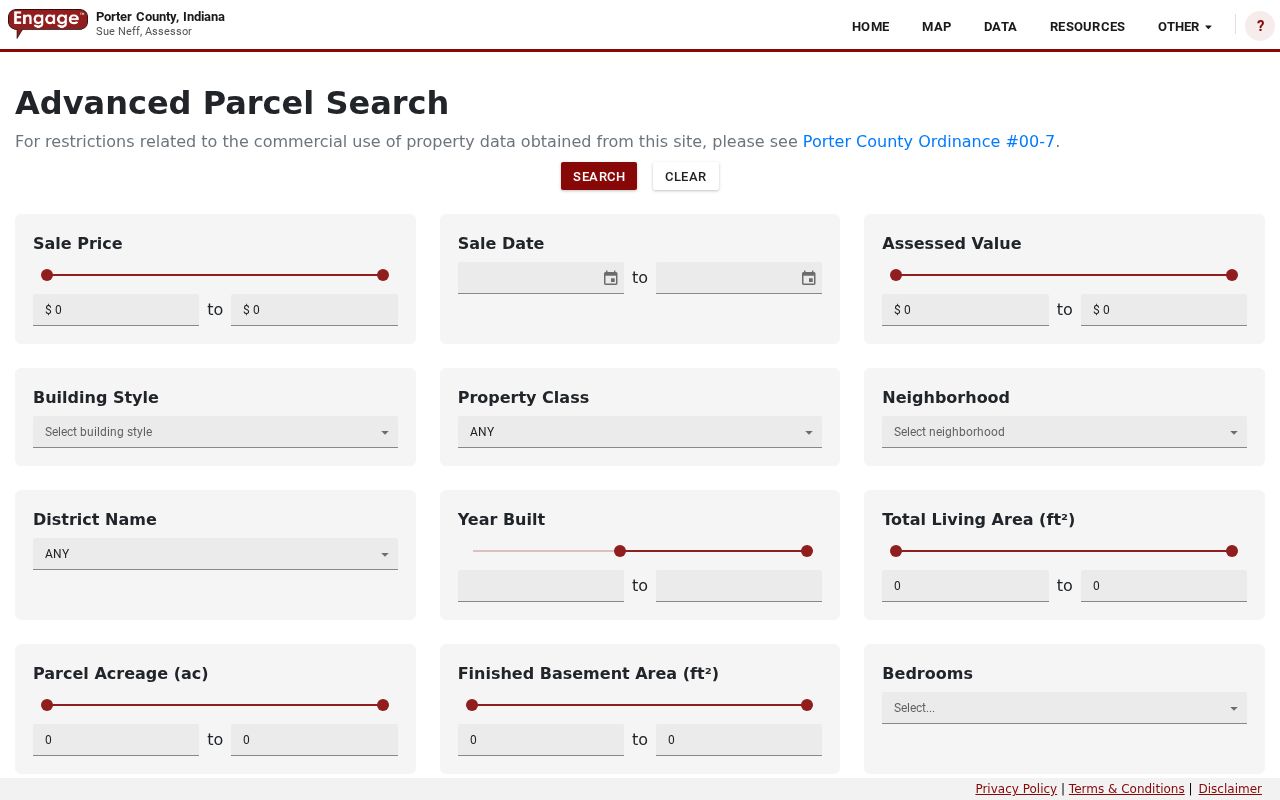
The captured screen confirms that district and neighborhood are assessment filters, not substitutes for a postal ZIP or city boundary.
Portage Records Keyed by Street
No office keeps a complete street directory. Porter County and Portage maintain separate rolls, maps, instruments, and case files. The parcel number joins many of them, while the legal description can survive an address change.
| Record | Keeper | Result | Access |
|---|---|---|---|
| Assessment card | County or township assessor | Owner, situs, mailing, transfers, improvements | Free XSoft; office fallback |
| Parcel map | Porter County GIS | Lots, roads, buildings, boundaries | Public map and REST layers |
| Recorded deed | County Recorder | Parties, date, instrument, legal description | Free index, paid images, terminal |
| Permit or code file | Portage departments | Project, inspection, occupancy, maintenance case | Inquiry or focused APRA request |
| Historic map or directory | Library and archives | Old road, business, or occupant clue | Scans, databases, staff inquiry |
The Portage Township Assessor is at 3590 Willowcreek Road, Suite C. County Assessor and Recorder counter work occurs in Valparaiso, so a search may require both cities.
Map Portage Streets in GIS
The Porter County GIS supplies parcel, building, road, municipal, township, section, subdivision, condominium, and annotation layers. A parcel click bridges map geometry to an XSoft card. Some parcels lack data, and a map point never proves that a named person resides there.
County guidance describes a 300-foot buffer: open the four-stack tool, choose Show Buffer Options, set 300 feet, continue, open the parcel-tab arrow, and export XLSX. That file is a nearby-parcel set, not a roster of households.
The Porter parcel viewer shows the map controls.
Roads and lot lines help identify the right parcel before names are checked. Porter County says map layers update on a 24-hour cycle.
Read Portage Address Labels
Four terms keep a Portage street directory result clear. Each describes a different part of the record.
- Parcel
- A county-tracked piece of land with its own identifier.
- Situs address
- The physical property address, which may differ from tax mailing.
- Plat
- A recorded subdivision map showing lots, blocks, roads, and dimensions.
- Criss-cross directory
- A directory arranged by street or phone number instead of surname.
XSoft separates owner, tax-mail destination, and physical parcel. A trust, estate, company, or out-of-town owner may appear. None of those labels lists every person in a home.
Link Portage Streets to Deeds
The Recorder's free Direct Search accepts name, recorded date range, or document type and reaches early 1978, but it supplies no images. Tapestry adds grantor, grantee, document number, parcel, subdivision, lot, block, consideration, and legal-description fields. The current county page lists $8.75 per index and image search and $1 per printed page.
The Porter deed index is the free first pass.
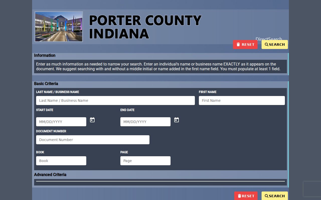
An index hit is only a pointer. Compare the image and legal description before joining it to a parcel.
The Tapestry instructions show the paid route.
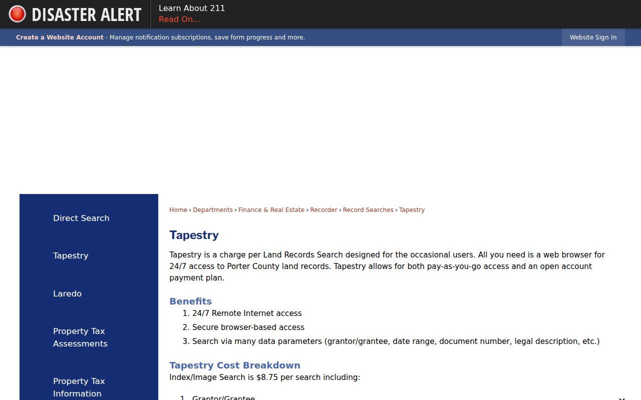
Online images and data begin in August 1980. Older books and microfilm require public terminals or office research. Staff do not search deeds by phone.
Portage Street Permit Records
The Building Department holds permit, inspection, plan, occupancy, sign, accessory-structure, and trade-work files. Code Enforcement handles maintenance, zoning, erosion, and violation requests. Research found no public address-search database for either set.
Give the exact address, parcel number, date range, and project type. Ask whether electronic, paper, inspection, and completion files exist. A specific request can use the city records form under Indiana APRA, but the city need not create a street list.
The Portage Code Enforcement source identifies this route.
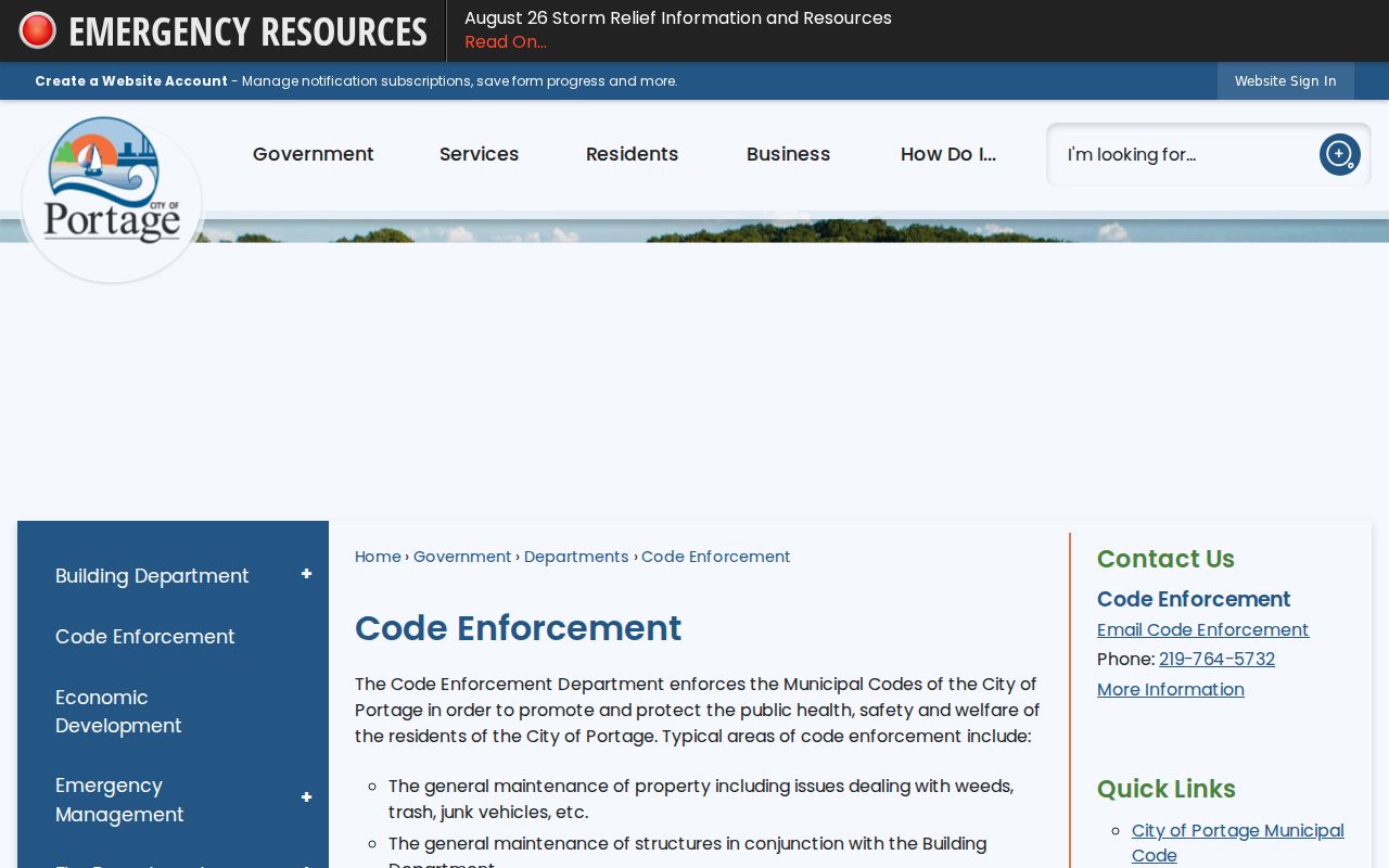
The source supports focused requests for one property, not an assumption that every case is online.
Portage Street Geography Clues
Portage Township dates to 1836. Older records may use Crisman, McCool, Garyton, Dunes Park, Portage Township, or a nearby postal place. Historic maps from 1876 onward can bridge roads, lots, and settlement labels.
No official citywide renumbering year was found. Compare Portage Township maps, Recorder legal description, subdivision plat, and Planning address files. XSoft also distinguishes PORTAGE CITY-PORTAGE TWP, PORTAGE CITY-WESTCHESTER TWP, PORTAGE TOWNSHIP, and adjacent districts. Those are tax keys, not ZIP codes.
Portage Directory Spelling Quirks
XSoft includes BEL AIR and BELAIR, STAGE COACH and STAGECOACH, plus the displayed form PRARIE RUN. Search the exact portal label and the plain spelling. Test street suffixes and directionals too.
Once found, save the parcel and legal description. Those keys give deed and map research a sound bridge when a street name, postal city, or subdivision label shifts.
Past Portage Residents by Street
Current parcel tools do not answer who lived there decades ago. Directories, census schedules, obituaries, probate files, and maps add the older layer. Standard directories often run name to address. Exact local criss-cross years were not verified.
Ask the PCPLS Genealogy Center for city, telephone, and reverse holdings by year. Search number, street aliases, township, and settlement label. The Portage city directory collections explain the volumes in depth.
Limits of Portage Street Records
A Portage street directory can show legal owners, parcels, recorded parties, permit applicants, or dated directory entries. It cannot list a full current household. Renters, relatives, guests, utility customers, and protected addresses may remain absent. Indiana also restricts covered-person names and addresses in property databases under IC 36-1-8.5.
The public voter tool does not show everyone on a block. Fuller products require a proper request and still withhold protected fields. Use each source only for the fact it supports.
Lawful use. Use Portage address records for legitimate personal research, never to stalk, harass, threaten, or expose a protected person.
When a portal fails, use the assessor office, GIS or Auditor contact, Recorder terminal, focused city request, or library staff. That fallback preserves the line between an official record and a guess.
Indiana APRA works best when a request names the custodian, exact address, record type, date range, and desired format. It can reach a particular existing permit or code file. It does not require an office to create a new directory, compile all names on a street, or perform open-ended research. A narrow request is both more accurate and easier for the city to answer.